Guide company releases investigation report on Perry Peak avalanche

TRUCKEE, Calif. – On Sunday, Aug. 9, the Blackbird Mountain Guide company released an independent investigation report on the Feb. 17 Perry’s Peak avalanche in the Castle Peak area that killed nine, including three of its guides.
Avalanche professional Don Sharaf conducted the investigation at BMG’s request and prepared a report, which provides a timeline of the ski trip’s events and decisions leading up to the avalanche. Sharaf also discussed the terrain the group was in, the route they took and alternative routes.
Released with Sharaf’s independent report is a supplemental document by Blackbird Mountain Guides (BMG), titled Key Findings and Clarifications, which discusses some of Sharaf’s key points.
Together, the documents discuss topics that have been largely unknown in the public sphere until now, including decisions to leave during high avalanche danger.
BMG says it provided copies of the report to authorities on July 27 and to the families and survivors on August 4, before making it publicly available.
The Nevada County Sheriff’s Office declined to comment on the independent investigation, but said it turned over its case to the District Attorney the week of August 3.
In the report, Sharaf provides background information on the individuals caught in the avalanche, noting that they were part of two separate ski groups who had joined together for the exit trek. Each group had been participating in a three-day overnight ski tour to the Frog Lake Huts through BMG. The avalanche occurred on the third day of the ski trip, on their journey back.
Decisions leading up to the avalanche
The report offers a chronological narrative of the three-day ski trip, from day one through day three, including the avalanche, rescue and recovery.
Within the timeline are considerations and decisions BMG guides and staff made leading up to the avalanche.
According to the report, discussion about the return journey occurred as early as the first day of the trip, when a routine morning meeting among guides covered the forecasted storm.
They identified a Tuesday (Feb. 17) morning break in the storm as a favorable weather window to return. Guides also determined the need to give avalanche slide paths a wide margin on the trip’s exit day. The meeting also established that the Red Dot Pass would be the best exit route.
In the afternoon of the second day of the ski trip, the day before the return and avalanche, trip leader Andrew Allissandratos had a phone call with BMG owner Zeb Blais. During the call, Allissandratos expressed confidence in their planned exit route, since he had previously exited the Frog Lake Huts during high avalanche danger.
The report reflects that after another 4-12 inches of snow overnight at the huts, the Sierra Avalanche Center issued a high avalanche hazard warning at 5:00 a.m. on the third day, Feb. 17.
Around 6:50 a.m., Allissandratos received forecast information from BMG staff in town that precipitation intensity would likely increase soon. The guide morning meeting discussed that the previously mentioned weather window was going to shut quickly. The guides did not allow the clients a morning ski lap before departure and instilled a sense of urgency to leave.
The group left at 9 a.m., according to the report. The avalanche occurred around 11 a.m.
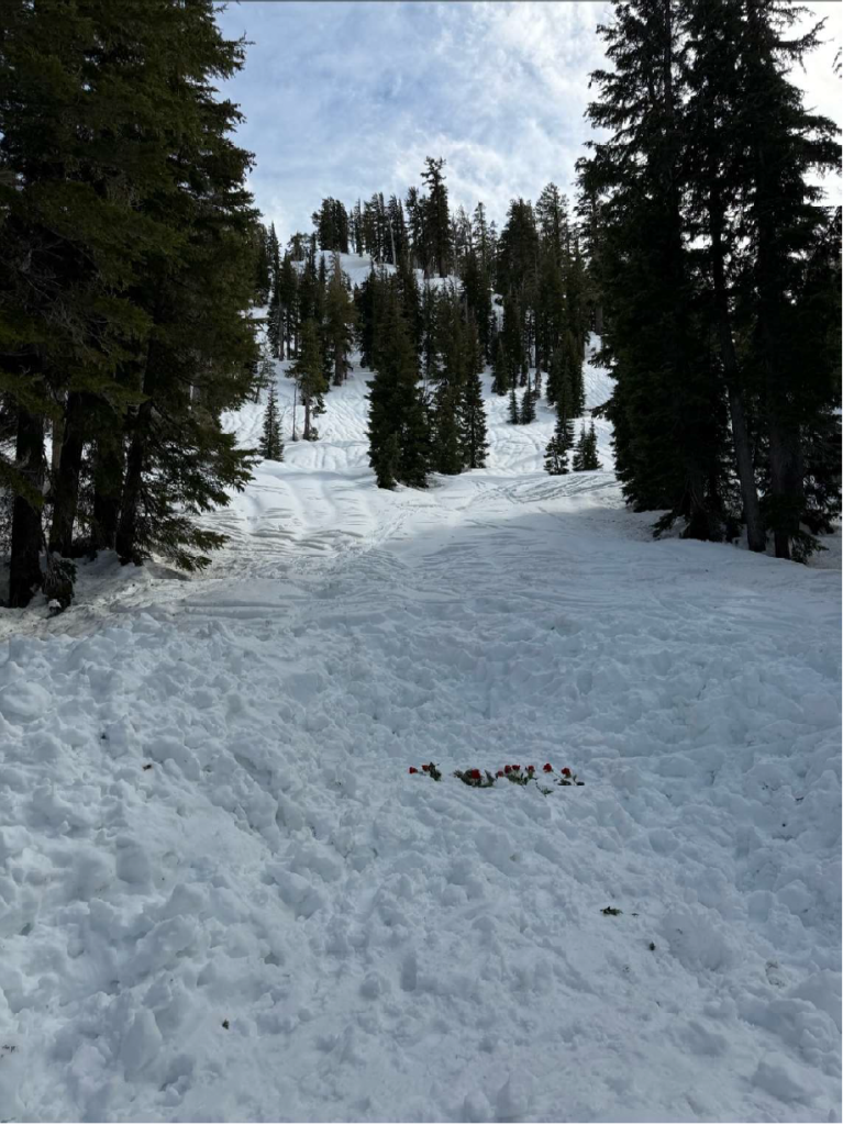
BMG’s supplemental document discussed operating during high avalanche danger. BMG explains it is common practice for trained mountain guides to operate in high avalanche danger and active storms, using risk management practices such as terrain and route selection, as well as weather and snowpack assessments. BMG continued to explain that avalanche danger ratings are regional forecasts intended to inform terrain selection and decision-making.
“They are not a prohibition on travel,” the document says. “Guiding under elevated avalanche hazard is a recognized and accepted professional practice when these methods are applied.”
The route taken and terrain
Sharaf’s report outlined the route the group took on their return journey over Red Dot Pass. The route is called the High Danger UP route and is intended for use during high avalanche danger.
The route is positioned to be beyond the reach of avalanche paths originating from Perry’s Peak. However, the report says it is generally on the far side of the creek, which, “Examining Choo’s Strava track (Figure 12) from 2/17/2026[,] the group appeared to make 2 to 3 separate attempts to cross to the far side of the creek, but were most likely turned back by open water and vertical creek sidewalls,” the report says.
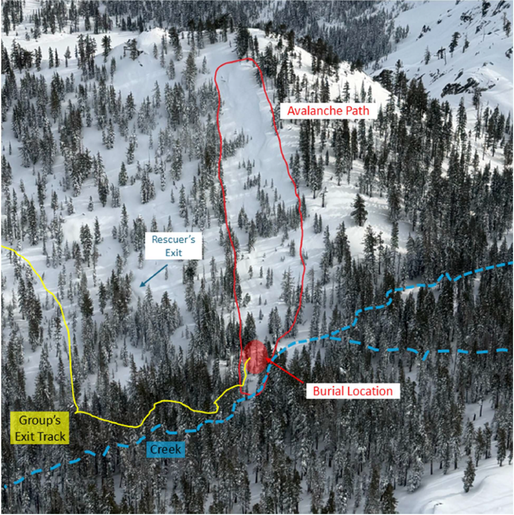
BMG says in its supplement that the creek is normally bridged by consolidated snow and is crossable in winter, but points to the season’s unusual conditions as a factor for the creek’s status.
Sharaf’s report also reveals that the group was buried approximately 50 feet away from the mapped route and explains that the burial location likely didn’t deviate far from their traverse path. The report also explains they were 30-50 feet away from the toe of the avalanche.
Also discussed are other main routes in and out, as well as the dangers of each route in those conditions, including the Johnson Canyon Route. Sharaf explains the avalanche terrain on this route could be bypassed, but requires crossing private property, which “has aggressively pursued trespassers in past years and knowledgeable parties avoid crossing that property boundary.”
The report provides photos of the private property’s entrance, which BMG highlighted in its supplement by noting what the property’s signs say: “WARNING NO TRESPASSING FIREARMS IN USE KEEP OUT.”
Sharaf reports the group was crossing a broad, flat-bottomed drainage in treed terrain. The report explains that a subtle gully near the burial site leads to a tree-lined alley that likely channeled the avalanche debris, causing it to travel as far as it did.
Sharaf’s report also discusses weather conditions, guide credentials, and trip information in detail.
The full report is available on blackbirdguides.com.



Support Local Journalism

Support Local Journalism
Readers around Lake Tahoe, Truckee, and beyond make the Sierra Sun's work possible. Your financial contribution supports our efforts to deliver quality, locally relevant journalism.
Now more than ever, your support is critical to help us keep our community informed about the evolving coronavirus pandemic and the impact it is having locally. Every contribution, however large or small, will make a difference.
Your donation will help us continue to cover COVID-19 and our other vital local news.