Drawing the line; The complicated history behind Lake Tahoe’s state border
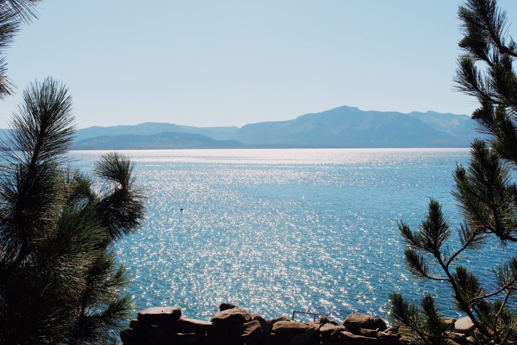
In the peak of summer, boats create wakes across the invisible line dividing Lake Tahoe between California and Nevada. No buoy marks the transition, and, while on the water, lakegoers may be unaware of the state line cutting the lake in two, or its complicated history.
On shore, the invisible line determines where casinos are located, how people are taxed, and a host of other regulations.
It’s also based on a series of errors and approximations spanning decades.
DRAWING BORDERS
The story begins in 1849 in Monterey, the former Mexican capital of what was called Upper California, which was acquired by the United States as a result of the Mexican-American War. With the discovery of gold on the American River, the Gold Rush was underway, and a group of delegates came together to discuss state boundaries for the large swath of land, which included present day Nevada, Utah and Arizona.
“They had a lot of concerns about the size of the state,” explains David Antonucci, a civil engineer and author of five Tahoe-based books, including “Yours, Mine, Ours,” a historical look at the people and environment of Lake Tahoe. “It would’ve been too big to administer. You had geographical barriers like the Sierra and the desert, and people wouldn’t be able to travel back and forth for government affairs.”
There were political considerations, like slavery and the Mormons who’d settled by the Great Salt Lake, but in the end, the decision was largely shaped by what they were pulling out of the ground.
“They wanted to make sure they captured all the gold fields,” Antonucci says, “and the most populated areas.”
Ultimately, the delegates decided to draw the line in the Sierra Nevada Mountains with the eastern edge following south along the 120th meridian to the 39th parallel. From there, a diagonal line ran southeast until it met the 35th parallel and followed the Colorado River.
It felt like a straightforward, practical solution. In reality, it was anything but.
CHAIN OF ERRORS
In 1844, explorer and topographer John C. Frémont set out from present-day Genoa, Nevada, with his party, including famed guide Kit Carson, to map the region. In the snowy February conditions, the men ascended what is now known as Red Lake Peak (10,068 feet) and caught their first sight of Lake Tahoe. Though the Washow Tribe had long called the area surrounding the alpine lake home, Frémont’s group was among the first documented, non-Indigenous explorers to view the cobalt waters.
But when it came to mapping the area, Frémont and his cartographer Charles Preuss ran into a problem.
“He had a chronometer with him to determine longitude,” Antonucci explains. “And it stopped due to the winter conditions.”
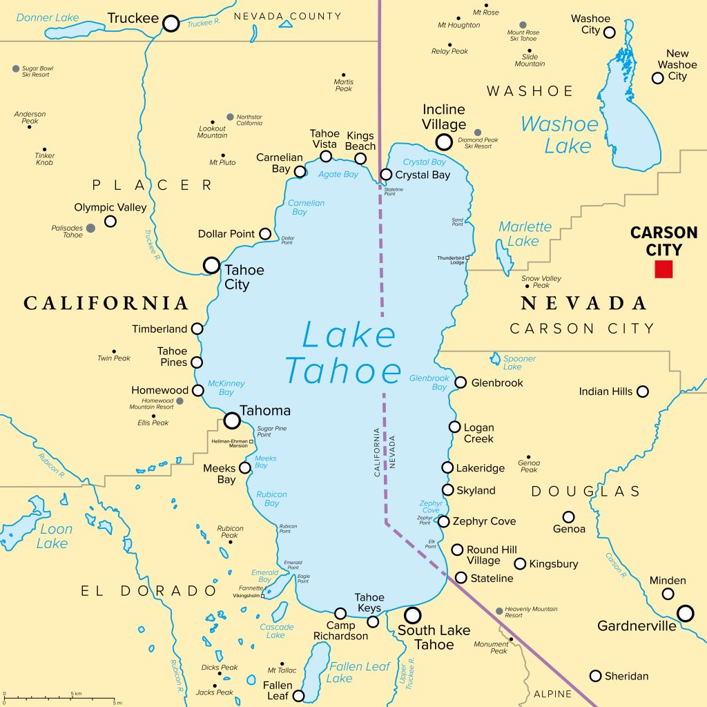
Without a working chronometer, Frémont had to estimate local time using celestial observations — a far less precise method. The result was a significant error: his map placed Lake Tahoe more than 30 miles west of its actual location. And it was this map that influenced the geography of the region and, ultimately, California’s eastern border, which delegates believed fully encompassed Lake Tahoe.
This mistake set off a chain of border issues for decades to come.
Over the next fifty years after statehood, surveyors were dispatched to different areas of importance to physically mark California’s eastern border, piece by piece, but consensus was hard to come by. In 1855, a surveyor set out to determine the angle point in the boundary and made a startling discovery: the border cut through the middle of Lake Tahoe rather than lying east of the giant lake. This early survey in Tahoe and another, which moved the line once again, were never cemented.
SILVER STATE
The border debacle came to a head when Nevada became a territory in 1861. According to Nevada Territory officials, who used a longitude system based on Washington, D.C., rather than Greenwich, their land included an area east of the Sierra Nevada crest that California laid claim to.
The overlapping claims resulted in a serious conflict.
In Honey Lake Valley, for example, judges from the Nevada and California counties both staking claim — and taxes — on the area were each arrested by the other county’s sheriff. When the conflict, dubbed the Sagebrush War, became briefly violent, the counties reached a truce and decided to petition their respective governors for clarity on the state line.
In 1863, California and Nevada made their first real joint attempt to mark the boundary on the ground through the Houghton – Ives Survey, an ambitious effort across rugged terrain that sought to turn the line on paper into physical markers. At Lake Tahoe, they had to project the line across open water from points on shore since they couldn’t measure out on the lake. Equipment limitations and difficulty measuring the diagonal line resulted in a usable, albeit not entirely accurate, boundary.
“They had actually pretty weak telescopes even then,” notes Antonucci. “It was pretty amazing what they did, given what they had to work with.”
In Aurora, a mining town along the southern diagonal border, residents voted in both state elections until it was resolved that they were indeed in Nevada. Deeds for properties and mining claims with the incorrect state listed had to be resolved in court.
Multiple additional surveys of the border up through 1899 resulted in different locations of the 120th meridian and the diagonal boundary by miles.
SET IN STONE
By the 1970s, California and Nevada still did not fully agree on where their shared border was, especially along the 120th meridian near Lake Tahoe.
The situation finally reached the courts in the California v. Nevada boundary case. The key question was whether to move the border to accurately match the original coordinates or keep it where surveyors had historically marked it.
Ultimately, the U.S. Supreme Court chose practicality over precision, ruling in 1980 to uphold the longstanding, albeit imperfect, boundary and putting to rest a century of border uncertainty.
Editor’s note: This article originally appeared in the Summer 2026 edition of Tahoe Magazine.




Support Local Journalism

Support Local Journalism
Readers around Lake Tahoe, Truckee, and beyond make the Sierra Sun's work possible. Your financial contribution supports our efforts to deliver quality, locally relevant journalism.
Now more than ever, your support is critical to help us keep our community informed about the evolving coronavirus pandemic and the impact it is having locally. Every contribution, however large or small, will make a difference.
Your donation will help us continue to cover COVID-19 and our other vital local news.