Respecting the storms of summer
ALL |
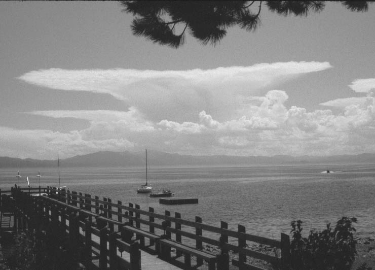
Springtime is a seasonal battleground between warm, moist air streaming in from the south and cooler, drier air pushing in from the north and west. The major storms of winter are history, but vigorous low-pressure systems in May and June can still cause dramatic weather in the Sierra and western Nevada. Late season intrusions of relatively cold air in the upper atmosphere can combine with the sun-heated landscape at the Earths surface to provide strong vertical lift and localized instability. Dynamic cloud development can quickly lead to severe thunderstorms capable of causing significant damage. Gusty winds, deadly lightning, swirling tornadoes, destructive hail, and torrential downbursts of rain with flash floods can occasionally blast our region. Lightning is the most deadly weather phenomenon associated with thunderstorms, killing an average of eight people a year in Nevada. Lightning tends to strike the highest objects around, such as the peaks and ridges of the Sierra. Lightning strikes immediately followed by cracking thunder are perhaps the most dramatic characteristics of a thunderstorm, but torrential rain and widespread downbursts of hail can cause significant damage. Reno and Carson City average between 10 and 15 thunderstorms a year with only about one hailstorm annually. Statistically, the Truckee-Lake Tahoe region averages an equal amount of summer storm activity, but hail generally occurs more frequently at higher elevations, especially above 6,000 feet.
Hailstones start out as small ice particles, but as they are tossed up and down inside a cloud by strong air currents, they absorb water droplets near the base of the cloud, which freezes as the particle is uplifted to the sub-freezing cloud tops. The more violent the air currents are, the taller the cloud and the larger the hailstones are likely to grow. Many residents and visitors in the mountains who claim to have seen snow during the months of July and August more often than not have observed hail piling up on the upper slopes and peaks. Severe thunderstorms are not a frequent feature in our regional climate, but when they do develop, never underestimate their potential danger.
Nevada is the driest state in the nation and may not be home to the countrys most intense thunderstorms, but when atmospheric conditions are right, water can pour from the sky into the desert. Nevadas most intense recorded rainfall occurred on May 29, 1896 at Cloverdale Ranch, about half way between Gabbs and Tonopah. Observer F.G. Troy reported 8.50 inches in one hour, with 6.50 inches in just 30 minutes. Thats more precipitation in half an hour than the region receives in an entire year. Troy noted that large hailstones stripped trees of leaves and that the first half-hour was a regular waterspout with extensive flooding. Thunderstorms are usually local in nature, but on May 29, 1896, a cluster of super convective storm cells hammered communities throughout eastern California and western Nevada. Thunderstorms generally reach their zenith late in the day after gaining strength from solar heating, but the Carson Weekly reported Friday morning hailstones fell nearly an inch in circumference and the last fall was accompanied by a deluge of rain, the like of which is seldom seen. The Carson River rose two feet. The Carson Morning News observed Fridays hail storm was very disastrous to the west side of Carson Valley mowing down the alfalfa and killing chickens. On one ranch, 18 fowls succumbed. Farther south along the eastern Sierra, the Walker Lake Bulletin reported not only rain, but weather that also caused serious transportation problems: A washout between Wabuska and the Reservation caused four cars on the north-bound train to leave the track. Nobody was hurt. The newspaper also noted that hailstones as large as quail eggs fell in Hawthorne. It sounded as if old Jupiter Pluvius was throwing stones on the house roofs.One storm looming over Surprise Valley, Calif., washed out every bridge and cut all communication. A flourmill containing 150,000 pounds of wheat and a large quantity of flour was completely washed away.
Residents in Reno did not escape the onslaught. At sunrise black, threatening clouds already towered over the Sierra Nevada range west of town. Ragged lightning flashed in the ominous sky and baritone thunder rumbled in the distance. Most people couldnt take their eyes from the sky and everyone wondered where would the storm strike? At 8 a.m. rain began falling. Within minutes the temperature began to plummet and ice hailstones began to pummel The Biggest Little City. This would be no typical summer storm. Hailstones averaging an inch or more in diameter blasted the region for nearly an hour. Pedestrians ran for cover while teamsters struggled to hold the reins of their panicked horses. According to the Nevada State Journal, Those who were out in the storm rushed to places of safety, protecting their faces and heads as best they could. A few persons carrying umbrellas raised them, hoping to protect themselves, but the covering was riddled as from a shower of bullets. Sky lights and windows were shattered and people worried whether a killer tornado would strike the town.In less than one hour the Truckee River rose more than two feet (indicating heavy rain upstream also), and Renos streets and roadways were filled with rushing torrents of muddy water. Ice-jammed gutters and broken windows allowed water to flow freely into homes and businesses, causing considerable damage to retail merchandise.On the outlying ranches the hail cut a heavy swath of destruction. Alfalfa and commercial truck gardens were completely ruined. Between Reno and Verdi several roads and bridges were washed out. Potato and onion fields near Glendale were wiped out with a total loss estimated at nearly $20,000. Glendale rancher William Waltz complained that the storm had cleaned him out of everything except the mortgage.
At Prosser Creek, north of Truckee, the storm turned deadly. Lumberjacks Larry Kimball and Nick Hines went out in a boat above a dam to tie down some runaway logs. They secured their boat with a rope, but the tether broke under the strain of the current and both boat and men went over the flooded spillway. John Hanrahan saw the two men floundering in the turbulent water below the dam, and in a commendable act of courage, he ventured out to the apron of the dam to try and hook one of the men with a logging spike. As Hanrahan leaned over the spillway to extend his reach, a loose log slid over the dam and killed him. Tragically, without his help, both Kimball and Hines drowned.This freak storm caused tens of thousands of dollars in damage and killed three people. Thousands of birds and chickens died, and a large part of western Nevadas fruit crop was ruined for two seasons, as all of the foliage and small twigs were stripped from the trees. Severe thunderstorms may be relatively rare in our region, but one should never lose their respect for these storms of summer. Mark McLaughlin’s column, “Weather Window,” appears monthly in the Sierra Sun. His award-winning books, “Western Train Adventures: The Good, the Bad & the Ugly” and “Sierra Stories: Trues Tales of Tahoe, Vol. 1 & 2” are available at local bookstores. Mark, a Carnelian Bay resident, can be reached at mark@thestormking.com.


Support Local Journalism
Support Local Journalism
Readers around Lake Tahoe, Truckee, and beyond make the Sierra Sun's work possible. Your financial contribution supports our efforts to deliver quality, locally relevant journalism.
Now more than ever, your support is critical to help us keep our community informed about the evolving coronavirus pandemic and the impact it is having locally. Every contribution, however large or small, will make a difference.
Your donation will help us continue to cover COVID-19 and our other vital local news.